The Palaeolithic Archaeological Potential of Pleistocene Deposits in England Project
Empowering archaeologists and planning authorities in their decision-making regarding potential Palaeolithic remains impacted by development
About the project
In recent years, it has become increasingly clear that there is great variability in responses to planning applications that impact on geological layers dating from the Pleistocene (2.6 million to 11.7 thousand years ago). Some jurisdictions require archaeological evaluation of all impacted layers, others only certain layers, while others view Pleistocene layers as 'the natural', i.e. of no potential archaeological value. The result of this situation is that in some parts of England, Palaeolithic sites are being damaged by development without having been recorded, while elsewhere, time and resources are being wasted on investigation of layers that lack archaeological potential.
This project, funded by and in collaboration with Historic England, is intended to enhance resources available to planning authorities in their consideration of the Palaeolithic period within the National Planning Policy Framework (Department for Communities and Local Government 2012). Achieving the aims of the project will allow curators working for planning authorities to make well informed, coherent and above all consistent (England-wide) decisions on how to treat Pleistocene layers that are to be impacted by development.
The project assumes a geological mapping approach pioneered in Hampshire by the Principal Investigator, Prof. Keith Wilkinson, Professor of Geoarchaeology. It aims to provide freely and easily accessible assessments of the archaeological potential of all Pleistocene geological layers in England via an online Geographic Information Systems (GIS) tool for curators. This resource will be implemented on the British Geological Survey's Land Feasibility Interrogation Tool (LandFIT) portal just as Historic England’s Palaeolithic guidelines are published (see below). The two resources will thus cross-fertilise and direct interested parties from one to the other.
The project will run in parallel with another Historic England-sponsored project, Curating the Lower and Middle Palaeolithic. Consultations carried out as part of this project highlighted a need for more background knowledge to enable decision-making appropriate for the Palaeolithic resource, particularly in terms of the geological context and the palaeo-environmental status of a site. Various interest groups and statutory bodies, including Historic England and its predecessor, English Heritage, have addressed this by issuing advice documents highlighting the value of the Palaeolithic. Curating the Lower and Middle Palaeolithic is a further example of this. it will lead to the production of new guidelines, due to be published soon, for managing the Palaeolithic archaeological resource.
Project team
Prof. Keith Wilkinson, Professor of Geoarchaeology (Principal Investigator)
Dr Monika Knul, Lecturer in Archaeological and Geographical Geomatics
Dr Jenni Sherriff, Lecturer in Physical Geography, King's College London
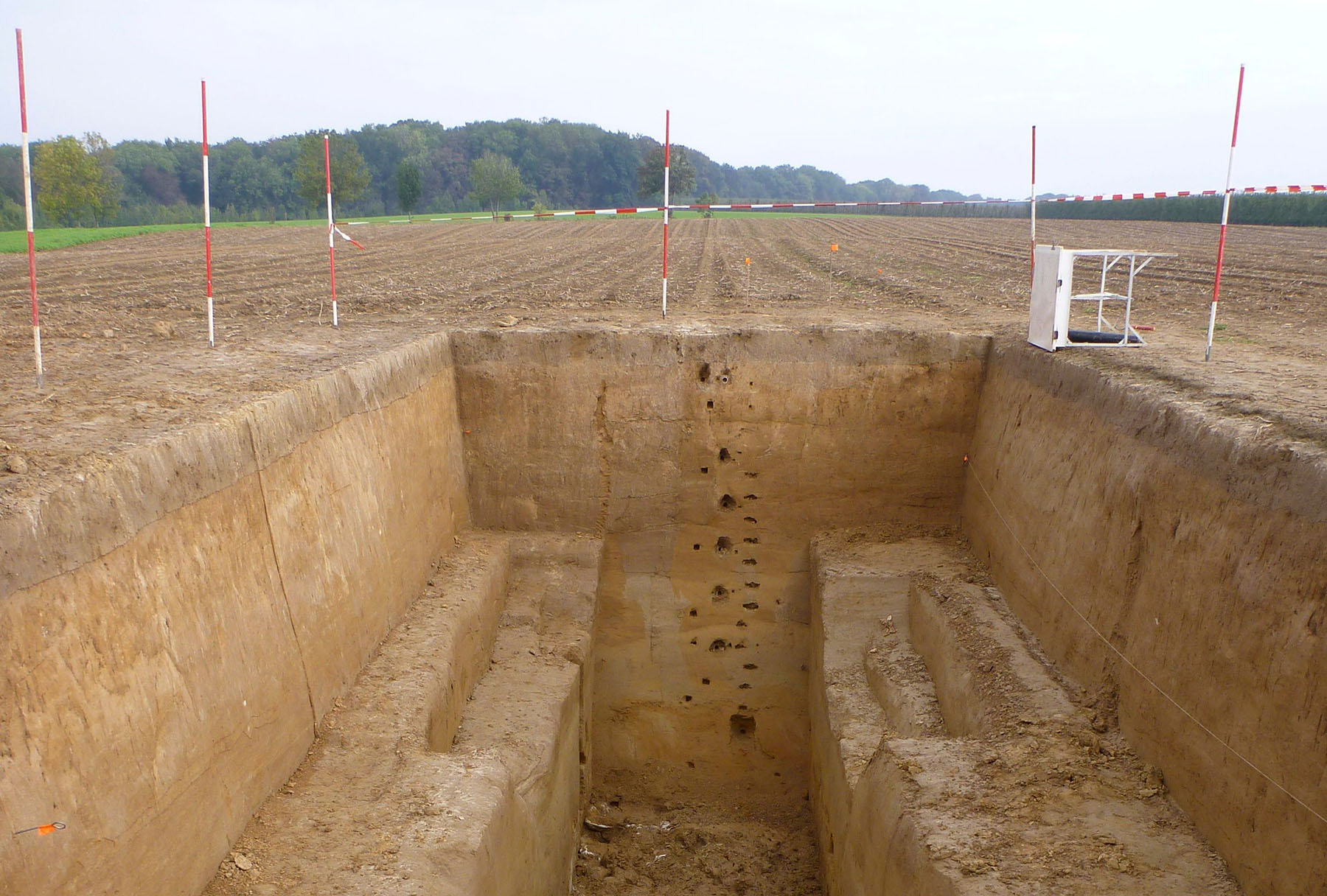
Background image: a Löss sequence containing in situ Middle Palaeolithic artefacts. The photo is of a site near Maastricht in the Netherlands, but similar contexts exist in eastern England. Image Keith Wilkinson.